Views
2018
Replies
7
Status
Closed
Let’s say I have a false-color elevation map, purple for low, then going up through blue, green, yellow, orange, red, and finally
white. Does anybody know a way to convert this into a simple grey scale height map? In other words, black = low, white = high.
Changing the image to greyscale is not sufficient, as the green and yellow areas stand out as higher than the red, due to their
higher luma values. If I have a rectangle with the colors in order, can I analyze that and apply it as a gradient to the rest of
the image? I ask this because most 3D programs I know only accept greyscale height maps as a displacement terrain map, and most
height maps I’m able to get use this false-color format instead…
Master Retouching Hair
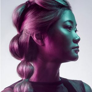
Learn how to rescue details, remove flyaways, add volume, and enhance the definition of hair in any photo. We break down every tool and technique in Photoshop to get picture-perfect hair, every time.